Florida Statewide and Regional ITS Architectures

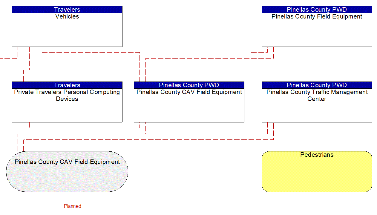
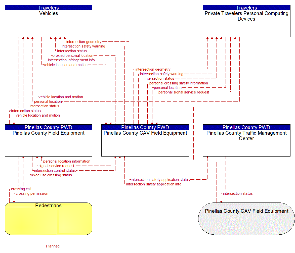
There are two diagrams below that represent this service package. The first is an interconnect diagram that just shows what elements are connected to each other. The second is an information flow diagram that shows the information flowing between the connected elements.

